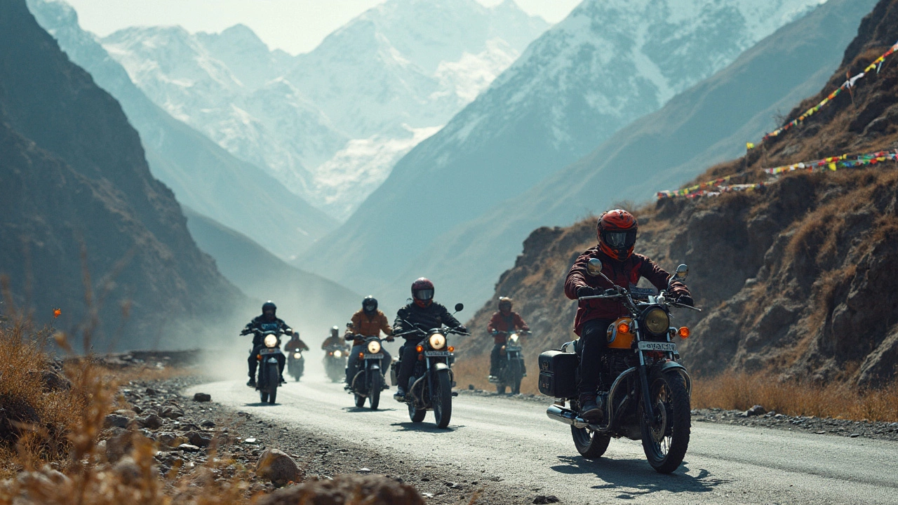
Ask anyone who’s into adventure sports in India about the 'largest trip,' and you’ll hear one answer on repeat—the route from Manali to Leh. This trip is not just long on the map (it's 470 km!), it’s huge on experience and adrenaline. Think endless hairpin bends, sun-blasted valleys, bone-rattling high passes, and stretches with more yaks than people.
The Manali-Leh expedition is seen as India’s gold standard in extreme road trips for bikers, cyclists, trekkers, and even 4x4 fanatics. Forget tamed highways—this route throws you into Himalayan chaos, with the world’s highest motorable passes like Tanglang La and Baralacha La standing in your way. You’re battling not just distance, but also dizzying altitude, unpredictable weather, and real isolation. If ‘adventure’ means pushing limits, there’s nothing bigger for sports lovers in India.
- What Makes the Manali-Leh Route So Massive?
- Highlights of the Expedition
- Preparation and Packing Tips
- Biggest Risks and How to Handle Them
- Pro Tips for a Safer, Smoother Ride
What Makes the Manali-Leh Route So Massive?
The Manali-Leh route stands out because it’s not just about covering kilometers—it's about battling distance, crazy altitude, and raw weather. Stretching around 470 km, it twists through the heart of the Himalayas, crossing five huge passes, including Baralacha La and Tanglang La, both soaring above 16,000 feet. That’s almost three times the height of most hill stations in India. No wonder experts call it the ultimate test for adventure junkies.
Most other adventure trips in India are maxed out at a few days and much lower elevations. Here, you're facing high-altitude zones for days. The oxygen levels drop, temp swings go from freezing to sun-scorched in hours, and resources are nearly zero in some stretches. This isn’t a quick joyride—you need grit and prep to even think about making it.
- Longest non-stop high-altitude journey in India—you’re above 10,000 feet for most of the ride.
- Solang Valley, Rohtang Pass, Sarchu, Pang, and finally Leh—all stops demand stamina and respect for nature.
- Very few fuel stations—one at Tandi (Keylong), then none till Karu, 350+ km later.
- No network signal for hundreds of kilometers—satellite phones are your best hope.
Check out these stats that show why this route is next-level hard:
| Segment | Elevation (ft) | Approx. Distance (km) |
|---|---|---|
| Manali to Rohtang Pass | 13,050 | 51 |
| Rohtang to Sarchu | Up to 16,500 (Baralacha La) | 177 |
| Sarchu to Pang | 15,500 | 75 |
| Pang to Tanglang La | 17,480 | 80 |
| Tanglang La to Leh | 11,500 | 87 |
The route’s wild terrain and altitude are why it has a short summer window—most of the year, snow blocks everything. Only late June to September are safe for crossing, and some years, landslides or floods wipe out chunks of road. If you want to experience the largest trip India adventure, there’s nothing else like the Manali-Leh expedition.
Highlights of the Expedition
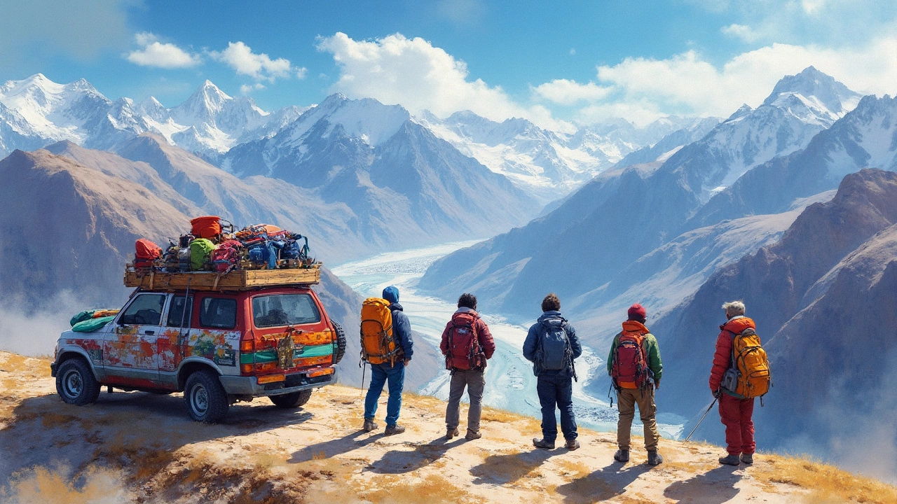
This route isn’t just about getting from point A to B; the Manali-Leh journey packs in so many iconic stops and features, it’s basically an adventure feast. You start in Manali’s green Kullu Valley, surrounded by pine forests, before heading up and out toward the sky-high Rohtang Pass. From there, it only gets wilder.
- Rohtang Pass: Sitting at 3,978 meters, this pass feels like the first big boss on the way out of Manali. Weather flips in minutes—one minute it’s sunny, next you’re in freezing fog.
- Keylong: The last spot with basic town comforts. Perfect for a night’s rest and stocking up on snacks and water. After this, facilities are rare.
- Baralacha La: At a whopping 4,890 meters, this pass is even higher than Rohtang and marks where you really start feeling the altitude. Views are jaw-dropping, with snow patches and turquoise lakes like Suraj Tal nearby.
- Gata Loops: A section of 21 back-to-back hairpin bends, famous for making both bikers and car drivers sweat. Your driving skills will get seriously tested here.
- More Plains: Suddenly you hit this completely flat, wide-open valley at 4,000 meters. The place looks like Mars—no trees, barely any people, just endless brown and gold landscape.
- Tanglang La: This is India’s second highest motorable pass at 5,328 meters. Crossing this, you get some epic bragging rights and killer 360° Himalayan views.
- Arrival in Leh: The feeling when you finally roll into Leh is unreal. The town offers more oxygen, cozy cafés, and a chance to actually wash the dust off. Plus, Leh’s old palaces and monasteries are worth a wander.
Here’s a quick look at the key figures you’ll tackle along this largest trip India route:
| Segment/Pass | Altitude (meters) | Distance from Manali (km) |
|---|---|---|
| Rohtang Pass | 3,978 | 51 |
| Keylong | 3,080 | 117 |
| Baralacha La | 4,890 | 203 |
| Gata Loops | 4,190 (avg) | 304 |
| Tanglang La | 5,328 | 365 |
| Leh | 3,500 | 470 |
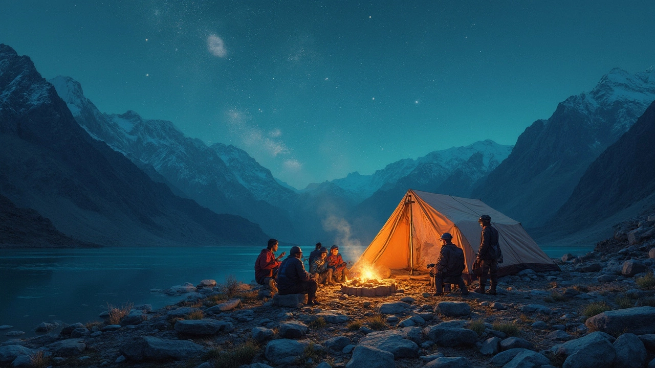
One more thing—this road is only open for about 4-5 months each year, usually June to September. Army trucks, bikers, and cyclists all share the same path, so you might even spot a massive convoy moving with you. And since phone signals vanish most of the way, people end up forming tight travel groups just to help each other out if things get rough. Trust me, few trips turn strangers into friends this fast.
Preparation and Packing Tips
Tackling the largest trip India offers isn’t about just showing up with a backpack. Altitude, weather swings, and remote stretches mean your prep can make or break the whole adventure. Here’s how to get ready for Manali-Leh like a pro.
First off, you’ll need to prepare for serious altitude changes. The route climbs from around 2,000 meters in Manali all the way to over 5,300 meters at Tanglang La. Altitude sickness is common—people start feeling symptoms around 3,000 meters. Spend at least a night or two in Manali to acclimatize before heading higher.
If you’re riding or driving, your vehicle needs damn-near perfect health. Fuel stations are few and far between—after Tandi, the next one is 365 km away, so carry at least 10 extra liters of fuel per bike or car. Bike service checks, new tires, and extra cables are a must. Cars—think spare tire, coolant, and an emergency tool kit.
- Clothes: Layering is key. Even in summer, mornings start near freezing. Pack a thermal base, warm fleece, waterproof jacket, and quick-dry pants. Don’t forget gloves and a good beanie.
- Medicines: For altitude, bring Diamox if you’re prone to sickness (consult your doc first). Add painkillers, a first-aid kit, and common meds for cold, fever, and upset stomach.
- Food & Water: Reliable pit stops are rare. Carry dry fruits, instant noodles, energy bars, and biscuits for the long gaps between dhabas (roadside cafes). Fill up bottles at every opportunity—a CamelBak or big insulated bottle saves hassle.
- Navigation: Don’t only trust your phone. Network fades often. Download offline maps (Google or Maps.me), and carry a hard-copy map as backup.
- Electronics: A power bank, extra phone battery, and solar charger are lifesavers. Charging points vanish on some stretches.
- Permits: You need Inner Line Permits for Rohtang Pass and sometimes for Leh; get them online or at Manali SDM office. Keep lots of photocopies handy for checkpoints.
Gear tip: good sunglasses protect your eyes from snow glare, especially if you hit Baralacha La on a sunny day. Sunscreen, lip balm, and moisturizer sound basic but help against windburn and sunburn at high altitudes.
Here’s a quick look at essential distances and altitude stats on the route:
| From | To | Approx Distance (km) | Elevation (m) |
|---|---|---|---|
| Manali | Rohtang Pass | 51 | 3,978 |
| Rohtang Pass | Keylong | 65 | 3,080 |
| Keylong | Baralacha La | 75 | 4,890 |
| Baralacha La | Sarchu | 40 | 4,290 |
| Sarchu | Tanglang La | 140 | 5,328 |
| Tanglang La | Leh | 115 | 3,500 |
Start early each day, take it slow if you feel breathless, and don’t ignore your body. Plenty of travelers have cut the trip short from pushing too fast, too soon. Prep right, and the mountains will be a lot kinder.
Biggest Risks and How to Handle Them
Taking on the largest trip India—that is, the Manali-Leh adventure—means you’re up against risks you can’t just laugh off. This isn’t a Sunday drive, so let’s get real about what can go wrong and how to stay safe:
- Altitude Sickness (Acute Mountain Sickness): The Manali-Leh highway hits heights over 17,000 feet (Tanglang La, to be precise). Common symptoms include headache, nausea, and dizziness. If ignored, it gets deadly.
- Sudden Weather Changes: Sunshine turns to snowstorm without warning, even in July. Visibility can drop in minutes. Roads turn slick or muddy fast.
- Remote Locations and Weak Connectivity: Between Keylong and Leh, you’re lucky to spot another person, let alone a mechanic. Mobile signals mostly vanish once you’re past Rohtang Pass.
- Vehicle Breakdowns: Engine trouble or tyre blows are common with steep climbs and rocky paths. Service stations are rare.
- Landslides and Roadblocks: The route is infamous for rockfalls, especially after heavy rain. You could get stuck for hours, sometimes days.
A Ladakh travel operator put it perfectly:
"The Manali-Leh highway doesn’t forgive mistakes. Underestimating the road or your own body’s limits can ruin your adventure—sometimes for good." — Mohan Sharma, Himalayan Road Expeditions
So, how do you handle these risks? Here’s what long-time travelers and local pros suggest:
- Get Ready for High Altitude: Spend at least one night in Manali before heading out, and ideally stop again at Keylong or Jispa. If you feel sick, it’s crucial to descend, not push on. Pop tablets like Diamox only after talking to a doctor.
- Check Weather and Road Updates: Use BRO (Border Roads Organisation) updates or chat with locals for the latest conditions. Don’t head out blindly because road closures are real and can leave you stranded.
- Carry Must-Have Emergency Gear: Pack a sturdy first-aid kit, spare tyre and tools, dry snacks, extra water, power banks, and a document with emergency contacts.
- Never Ignore Oxygen Levels: At least one small portable oxygen cylinder per vehicle is smart, especially for newcomers. Pulse oximeters (those little finger gadgets) help you know if your blood oxygen is dropping before you feel awful.
- Fuel Up in Advance: There’s only one fuel station between Tandi (after Keylong) and Karu near Leh, and that’s roughly 350 km apart. Always fill up at Tandi, even if your tank is nearly full.
Here’s a quick look at the main trouble spots and what to expect:
| Spot | Altitude (ft) | Main Risks |
|---|---|---|
| Rohtang Pass | 13,050 | Landslides, traffic jams, hypothermia |
| Baralacha La | 16,040 | Severe AMS risk, snow, breakdowns |
| More Plains | 15,500 | Sandstorms, no shelter, flat tyres |
| Tanglang La | 17,480 | Extreme altitude, low oxygen, weather swings |
If you take these risks seriously and prep right, the Manali-Leh trip becomes less scary and way more rewarding. Don’t try to be a hero—listen to your body, your crew, and the mountain.
Pro Tips for a Safer, Smoother Ride
So, you’re eyeing the Manali-Leh adventure? Here’s what experienced riders, trekkers, and even tour operators swear by—tips that can help you stay safe and actually enjoy the journey instead of just surviving it.
- Acclimatize properly. Don’t rush it. Spend at least a day in Manali (at about 2,050 meters) before hitting the road. Fast ascents mean headaches, nausea, and sometimes way worse. Plan your stopovers—Keylong and Sarchu are popular because they give your body time to adapt.
- Check your ride, twice. Whether you’re going by bike, jeep, or cycle, get your brakes, tires, and suspension checked in Manali. Have a toolkit, spare tubes, and patch kits. Service centers are rare on the highway.
- Layer your clothes. It might be sunny in the valleys, but Rohtang Pass and Tanglang La can get below freezing, even in June. Quick-dry tees under windproof jackets actually work better than bulky winter gear.
- Stock up on snacks and water. You’ll find food at dhabhas here and there, but the next stop can be hours away. Carry instant noodles, protein bars, and at least 2-3 liters of water per person. Water sources may have risk of contamination, so pack purifying tablets or a LifeStraw.
- Keep your phone alive—literally. Mobile signal is spotty. BSNL has the best coverage, but many stretches have no signal at all. Carry a power bank. Download offline maps, not just Google Maps but offline GPS apps like Maps.me.
- Slow and steady wins (and lives). Don’t try to set speed records here. Landslides, black ice, and blind curves catch even pros off guard.
- Leave buffer days. Weather up here laughs at your plans. Landslides and snow can shut down roads for hours—or a day. Don’t book your return flight the day after you’re supposed to finish.
| Fact | Data |
|---|---|
| Total Distance | 470 km |
| Highest Pass (Tanglang La) | 5,328 meters above sea level |
| Common Travel Window | June to mid-September |
| Average Time to Complete | 2-4 days (if not trekking) |
| Fuel Availability | Only one fuel pump at Tandi (after Manali, before Leh) |
If you remember only one thing, let it be this: the largest trip India offers is about patience, smart planning, and giving Mother Nature her due respect. Most problems happen when folks get cocky or cut corners, so take the time to prep. You’ll thank yourself once you’re out there in the high Himalayas.